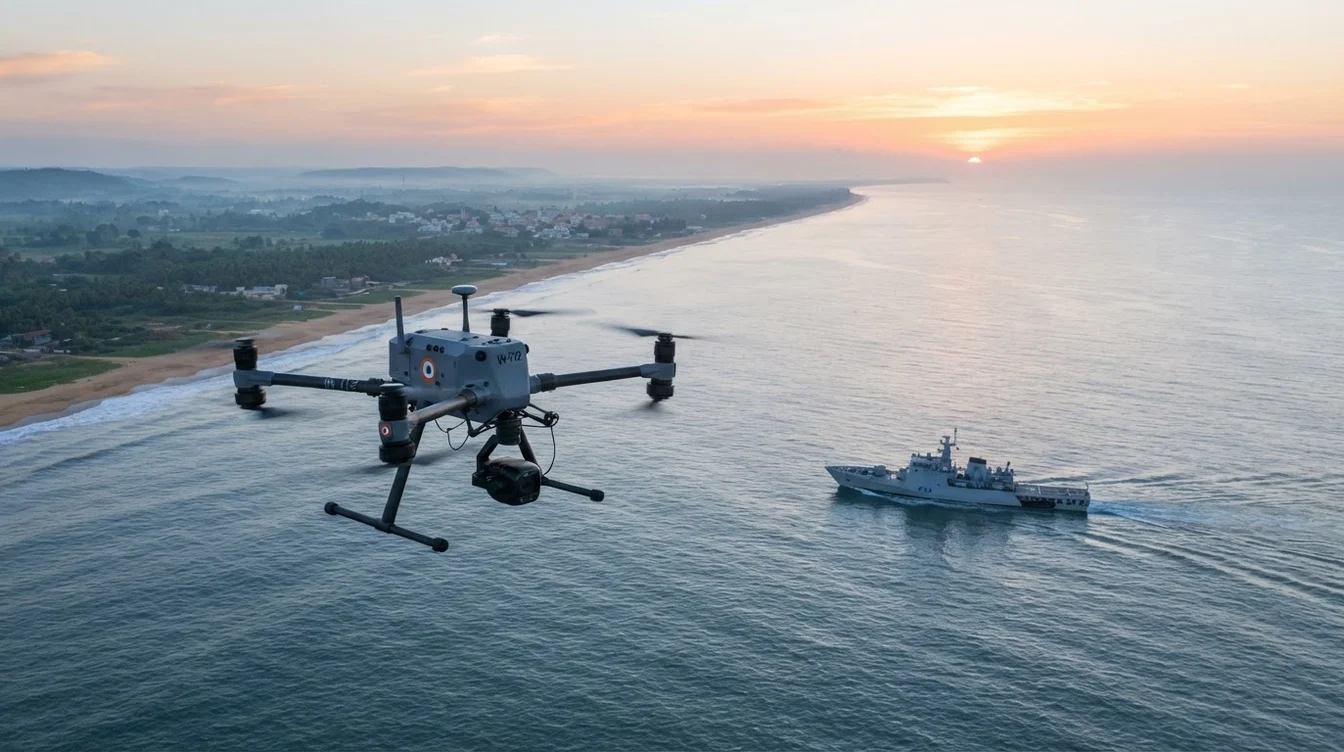
Maritime Drone Surveillance: Boosting Coastal Security & Naval Operations in India
India's strategic location, with its vast coastline stretching over 7,500 kilometers, positions it as a significant maritime nation. This extensive maritime frontier, encompassing critical ports, vital shipping lanes, and rich marine resources, is simultaneously a source of economic prosperity and a complex security challenge. From illegal fishing and smuggling of narcotics and arms to potential terrorist infiltration and environmental threats like oil spills, the need for robust, continuous surveillance is paramount. Traditional methods, while essential, often face limitations in terms of cost, endurance, and human risk. This is where the transformative power of drone technology, specifically maritime drone surveillance, comes into play, offering an unprecedented level of vigilance and operational efficiency for India's coastal security and naval forces.
India's Maritime Landscape: Challenges and the Imperative for Advanced Surveillance
The Indian Ocean Region (IOR) is a geopolitical hotspot, making India's maritime domain a critical area for national security. The challenges are multifaceted:
- Illegal, Unreported, and Unregulated (IUU) Fishing: A significant threat to marine ecosystems and the livelihoods of legitimate fishers, often involving cross-border incursions.
- Smuggling: The long, porous coastline, particularly in states like Gujarat, makes it vulnerable to the smuggling of contraband, including narcotics, weapons, and even human trafficking.
- Terrorism: The 26/11 Mumbai attacks tragically demonstrated the vulnerability of India's coastline to waterborne infiltration, underscoring the need for perpetual vigilance.
- Piracy: While largely contained further west in the Gulf of Aden, the potential for spillover effects and the need to protect Indian shipping interests remain.
- Environmental Monitoring: Monitoring for oil spills, marine pollution, and safeguarding sensitive coastal ecosystems requires constant oversight.
Conventional surveillance methods, relying on patrol boats, manned aircraft, and static radar systems, are often resource-intensive, have limited endurance, and can be constrained by weather conditions. Drones offer a cost-effective, rapidly deployable, and persistent solution, capable of operating in conditions that might be risky for human personnel.
Empowering Coastal Security with Drone Technology
For agencies like the Indian Coast Guard and local law enforcement, drones are rapidly becoming indispensable tools. Maritime drone surveillance provides real-time, actionable intelligence that significantly enhances their capabilities:
- Persistent Patrol and Reconnaissance: Drones can conduct long-duration patrols over vast stretches of coastline and territorial waters, significantly extending the reach of surveillance efforts. Equipped with high-resolution Electro-Optical (EO) cameras, they can identify vessels, track their movements, and record crucial details in daylight conditions.
- Real-time Threat Detection: Integrating advanced sensor payloads allows for the detection of suspicious activities. Thermal (Infrared or IR) cameras are critical for night operations or in low-visibility conditions like fog, allowing operators to spot heat signatures from vessels or individuals that would otherwise go unnoticed. This is vital for intercepting illegal activities under the cover of darkness.
- Search and Rescue (SAR) Operations: In distress situations, drones can be rapidly deployed to cover expansive search areas much faster than traditional methods. Their aerial perspective, combined with thermal imaging, can quickly locate individuals in water or on remote coastal stretches, drastically reducing response times and improving survival rates.
- Environmental Monitoring: Drones can precisely map and monitor oil spills, track pollution plumes, and assess damage to coastal ecosystems. This data is crucial for rapid containment efforts and subsequent environmental impact assessments.
- Port and Harbour Security: Monitoring vessel movements, identifying unauthorized access, and inspecting infrastructure within busy port areas are critical tasks. Drones can provide overhead views, ensuring comprehensive coverage and rapid response to security breaches.
Modern maritime drones can carry payloads weighing several kilograms, allowing for a combination of sensors. For instance, an integrated system might include a 30x optical zoom EO camera for detailed visual inspection, a thermal imager with a range of several kilometers for night detection, and an Automatic Identification System (AIS) receiver. The AIS receiver is particularly useful as it picks up transponder signals from legitimate vessels, allowing operators to quickly identify any non-compliant or "dark" targets not broadcasting their position. Data is typically streamed in real-time to a ground control station, often with geo-tagging accurate to within a few meters, providing precise location data for any detected anomaly.
Naval Applications: Enhancing Operational Capabilities
Beyond coastal security, the Indian Navy is increasingly exploring and integrating drone technology for a range of strategic and tactical applications. The ability of drones to operate in contested environments, provide extended situational awareness, and reduce risk to manned assets makes them invaluable.
- Over-the-Horizon (OTH) Reconnaissance: Ship-borne drones, capable of vertical take-off and landing (VTOL), can be launched from naval vessels to scout ahead, providing critical intelligence on enemy formations, vessel movements, and potential threats far beyond the ship's radar horizon. This greatly enhances the situational awareness of naval task forces.
- Port and Naval Base Security: Drones offer an additional layer of security for critical naval installations. They can patrol restricted waters, monitor perimeter fences, and inspect underwater infrastructure using specialized payloads.
- Battle Damage Assessment: Following engagements or incidents, drones can quickly assess damage to friendly or enemy vessels and infrastructure, providing commanders with rapid, accurate information for decision-making.
- Intelligence, Surveillance, and Reconnaissance (ISR): Drones can collect vital intelligence on adversary activities, monitor choke points, and support special operations forces by providing real-time aerial views of target areas.
- Targeting Support: By providing precise geo-referenced coordinates of targets (often with RTK/PPK GPS accuracy down to a few centimeters), drones can improve the accuracy of naval gunfire and missile strikes, reducing collateral damage.
- Anti-Submarine Warfare (ASW) Support: While not direct ASW platforms, drones can assist by identifying potential surface contacts, monitoring suspicious activity in designated areas, and even deploying sonobuoys experimentally to expand the search area for submarines.
Advanced naval drones are often equipped with Synthetic Aperture Radar (SAR) payloads. SAR can penetrate clouds and adverse weather conditions, providing high-resolution imagery day or night, making it exceptionally effective for detecting and tracking vessels even in challenging maritime environments where optical sensors might be limited.
Navigating the Skies: DGCA Regulations and Operational Practicalities in India
The deployment of drones for maritime security and naval applications in India operates under the comprehensive framework of the Directorate General of Civil Aviation (DGCA) Unmanned Aircraft System (UAS) Rules, 2021, and subsequent amendments. Adherence to these regulations is not just a legal requirement but a fundamental aspect of safe and effective operations.
Key regulatory considerations include:
- Remote Pilot License: All drone operators must possess a valid Remote Pilot License issued by a DGCA-approved drone school.
- Drone Registration: Every drone must be registered on the Digital Sky platform and obtain a Unique Identification Number (UIN) and a Drone Acknowledgement Number (DAN).
- Airspace Restrictions: Operations are governed by a color-coded zone system (Green, Yellow, Red) on the Digital Sky platform. Maritime operations, especially near sensitive naval installations or international borders, often fall into Yellow or Red zones, requiring specific permissions from the DGCA and relevant authorities (e.g., Ministry of Defence, Ministry of Home Affairs).
- Visual Line of Sight (VLOS): Most commercial drone operations are restricted to VLOS, meaning the pilot must maintain direct visual contact with the drone. However, for extensive maritime surveillance, Beyond Visual Line of Sight (BVLOS) operations are crucial. While BVLOS flights are currently largely experimental in India, the DGCA is working on frameworks to allow for more widespread BVLOS operations under strict approvals, which will be a game-changer for long-range maritime missions.
- Payload Restrictions: Drones must comply with specified weight and payload limits, and certain restricted payloads may require additional clearances.
- Flight Height and Distance: Drones typically have height restrictions (e.g., 400 feet AGL in green zones) and may have limitations on their operational range depending on the airspace and nature of the mission.
Beyond regulations, operational practicalities in the maritime environment present unique challenges:
- Harsh Weather Conditions: Salt spray, high humidity, strong winds, and corrosive environments demand rugged, weather-resistant drones with high ingress protection (IP) ratings.
- Communication Challenges: Maintaining stable data links over open water can be difficult, requiring advanced communication systems and redundant links.
- Launch and Recovery: For ship-borne operations, specialized automated launch and recovery systems are essential to ensure safe deployment and retrieval in dynamic sea conditions.
- Data Security: The sensitive nature of surveillance data necessitates robust encryption and secure data handling protocols to prevent unauthorized access.
The AiRotor Labs Advantage: Precision and Expertise in Maritime Drone Surveillance
At AiRotor Labs, located in Ahmedabad, we understand the complexities and critical nature of maritime drone surveillance in India. We combine cutting-edge drone technology with deep operational expertise to provide comprehensive, reliable, and compliant solutions for coastal security and naval applications.
Our capabilities include:
- Advanced Drone Fleet: We deploy state-of-the-art drones equipped with high-resolution EO/IR cameras, AIS receivers, and other specialized payloads tailored for maritime environments. Our drones are built for endurance and resilience against harsh weather.
- DGCA-Certified Pilots: Our team comprises highly trained and DGCA-certified remote pilots with extensive experience in challenging operational scenarios, ensuring safe and compliant flight operations.
- Customized Solutions: We work closely with our clients to understand their specific surveillance needs, designing bespoke drone solutions that deliver actionable intelligence, whether it's for coastal patrol, port security, environmental monitoring, or naval support.
- Data Analysis and Reporting: Beyond just flying drones, we provide comprehensive data processing and analysis services, transforming raw footage and sensor data into clear, concise, and actionable reports.
- Regulatory Compliance: We meticulously adhere to all DGCA regulations, assisting clients with necessary permissions and ensuring
AiRotor Labs provides drone-based inspection, aerial survey, and land survey across India.
Book a consultation →