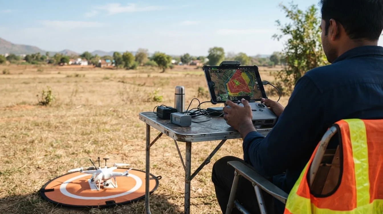
Navigating DGCA Drone Regulations in India 2026: An Operator's Guide
Drones have rapidly evolved from niche gadgets to indispensable tools across industries in India. From inspecting critical infrastructure like powerlines and wind turbines to conducting precise land surveys for urban planning, unmanned aerial vehicles (UAVs) are transforming how businesses operate. As this technology matures, so does the regulatory framework governing its use. For any drone operator or business leveraging drone services, understanding the DGCA drone regulations in India 2026 is not just about compliance; it's about ensuring safety, efficiency, and the long-term viability of operations.
This guide aims to cut through the jargon and provide a clear, practical overview of what drone operators need to know as we move further into 2026. While 2026 doesn't mark a complete overhaul of existing rules, it signifies a period where the established Drone Rules 2021 and subsequent amendments are fully integrated, and enforcement is streamlined. Staying informed and compliant is paramount for unlocking the full potential of drone technology in India.
The Evolving Landscape of Indian Drone Regulations
India's journey in drone regulation has been dynamic, moving from initial restrictions to a more progressive, enabling framework designed to foster innovation while ensuring safety. The Drone Rules 2021, which came into effect in August 2021, dramatically simplified the regulatory process, replacing archaic requirements with a more user-friendly, digital-first approach. This was further refined by the Drone (Amendment) Rules 2022, introducing concepts like the Drone Shakti initiative and further liberalizing certain aspects.
By 2026, the industry is operating under a well-established system centered around the Digital Sky Platform – a single-window online platform for all drone-related permissions. This shift towards self-regulation in green zones, coupled with stringent oversight in yellow and red zones, has made drone operations more accessible for legitimate operators. The emphasis is now on operational maturity, adherence to established protocols, and leveraging technology for seamless compliance. For operators, this means a stable regulatory environment, but one that demands thorough understanding and consistent application of the rules.
Key Pillars of DGCA Compliance for 2026
Operating a drone commercially in India requires adherence to several fundamental regulatory pillars. These are the bedrock of DGCA drone regulations in India 2026:
1. Drone Type Certificate (TC) & Unique Identification Number (UIN)
Every drone (excluding nano drones and those for R&D purposes) operating in India must possess a Type Certificate issued by the DGCA, affirming its airworthiness and compliance with safety standards. This is typically obtained by the manufacturer. Following this, each drone must have a Unique Identification Number (UIN), which is like a registration plate for your UAV. The process for obtaining a UIN is entirely online via the Digital Sky Platform, linking the drone to its owner/operator.
2. Remote Pilot Certificate (RPC)
Anyone operating a drone (other than nano drones flown below 15 meters in non-commercial settings) needs a Remote Pilot Certificate. This certificate is issued by the DGCA after successful completion of training from a DGCA-approved Remote Pilot Training Organization (RPTO). The training covers drone aerodynamics, meteorology, air law, flight planning, and practical flying skills. Different categories of drones (micro, small, medium, large) may require specific endorsements or separate training modules.
3. Operational Permissions (OA/UASO)
Before every flight, drone operators must obtain specific operational permission through the Digital Sky Platform.
- Green Zones: These are designated areas where no permission is required for flying up to 400 feet (for micro drones up to 200 feet). However, mandatory intimation of the flight details to the Digital Sky Platform is still required.
- Yellow Zones: These areas require explicit permission from the relevant Air Traffic Control (ATC) authority. This process is initiated through the Digital Sky Platform and typically involves a review period, ranging from a few hours to a few days depending on the complexity and location.
- Red Zones: These are no-fly zones, such as near airports, international borders, or sensitive government installations. Operations in red zones are strictly prohibited unless special, rare permissions are granted by the central government. For complex operations like Beyond Visual Line of Sight (BVLOS) or night flying, additional, stringent permissions and safety assessments are mandatory.
4. Third-Party Liability Insurance
All drone operations, except for nano drones, must be covered by appropriate third-party liability insurance. This protects operators against potential damages to property or injury to individuals caused by drone operations. The minimum coverage amount is specified by the DGCA and is crucial for responsible operations.
5. Maintenance & Airworthiness
Operators are responsible for ensuring their drones are maintained according to manufacturer guidelines and remain airworthy. This includes regular checks, proper documentation of flight hours, maintenance logs, and prompt reporting of any incidents or defects.
Operational Specifics: What DGCA Rules Mean for AiRotor Labs' Services
At AiRotor Labs, we specialize in advanced drone services, and our operations are meticulously planned to comply with every aspect of DGCA drone regulations in India 2026. Here's how these regulations translate to our core offerings:
Drone-Based Inspection (Solar, Wind, Powerline, Transmission Line)
Inspecting critical infrastructure often involves flying over vast areas, sometimes in remote locations.
- Flight Planning & Permissions: Our teams meticulously plan flight paths, identifying green/yellow zones and securing necessary OAs well in advance, typically requiring 2-5 days for approval in standard yellow zones.
- Sensor Technology: For solar panel inspections, thermal cameras (e.g., FLIR Zenmuse XT2) detect hotspots and cell damage, while high-resolution RGB cameras capture visual defects. For wind turbines and powerlines, high-zoom RGB cameras and sometimes LiDAR sensors are used for structural integrity checks and vegetation management.
- Accuracy: We utilize drones equipped with RTK/PPK GNSS for sub-centimeter accuracy in mapping and precise defect localization, crucial for maintenance planning.
- Safety: Our drones feature obstacle avoidance systems, and our pilots maintain constant visual line of sight (VLOS) or operate under specific BVLOS permissions where applicable, always adhering to safety protocols.
Aerial Survey & Land Survey
Precision is paramount in aerial and land surveys for urban planning, construction, and resource management.
- Mapping Grade Drones: We deploy drones integrated with RTK/PPK GNSS modules, which correct GPS data in real-time or post-process, eliminating the need for extensive Ground Control Points (GCPs) in many scenarios, thereby speeding up field operations.
- Sensor Types: High-resolution RGB cameras (e.g., 42MP full-frame sensors) are standard for photogrammetry, generating orthomosaics, 3D models, and Digital Elevation Models (DEMs). For specialized applications like corridor mapping or volumetric calculations, LiDAR sensors provide highly accurate point clouds.
- Accuracy: Our surveys consistently achieve horizontal accuracy of 1-3 cm and vertical accuracy of 2-5 cm, meeting industry standards for large-scale mapping projects.
- Data Processing: Raw data is processed using industry-leading photogrammetry software like Pix4D Mapper or Agisoft Metashape, ensuring deliverables meet client specifications and regulatory standards.
Special Considerations
Operations like night flying or BVLOS require separate, more rigorous permissions and often involve a DGCA-approved safety case. AiRotor Labs has the expertise and procedures in place to navigate these complex requirements, ensuring all specialized operations are conducted legally and safely.
The Role of Technology in Compliance and Operations
The DGCA's vision for drone operations is deeply intertwined with technological advancements.
- Digital Sky Platform: This online portal is the central nervous system for all regulatory interactions – from UIN application to flight plan submission and permission acquisition.
- Geofencing: Most modern commercial drones have built-in geofencing capabilities that prevent them from entering no-fly zones or exceeding altitude limits, providing an essential layer of safety and compliance.
- Drone Traffic Management (UTM): While still evolving, India is moving towards a sophisticated UTM system that will enable real-time tracking, de-confliction, and management of drone traffic, further enhancing safety and operational efficiency.
- Advanced Sensors & Automation: RTK/PPK, obstacle avoidance, and intelligent flight modes not only improve the quality of data collection but also contribute to safer and more compliant operations by reducing human error and improving situational awareness.
Staying Ahead: Preparing for DGCA Drone Regulations in India 2026 and Beyond
For operators, staying proactive is key. The drone industry is dynamic, and while the core DGCA drone regulations in India 2026 are stable, minor amendments or new advisories can emerge.
- Continuous Training: Invest in recurrent training for pilots and technical staff to stay updated on best practices, new technologies, and regulatory changes.
- Invest in Certified Technology: Ensure your drone fleet consists of Type Certified drones and that all equipment meets DGCA specifications.
- Monitor DGCA Updates: Regularly check the DGCA website and Digital Sky Platform for circulars, advisories, and any amendments to the rules.
- Partner with Experts: Collaborating with experienced drone service providers like AiRotor Labs ensures your projects are executed with full regulatory compliance and the highest safety standards. Our in-depth understanding of the nuances of Indian drone laws allows us to deliver efficient, legal, and high-quality services.
Understanding and adhering to the DGCA drone regulations in India 2026 is not just a legal obligation; it's a commitment to safety, professionalism, and the sustainable growth of the drone industry. By staying informed and operating responsibly, we can collectively harness the transformative power of drones for a better, more efficient future.
Need professional drone services in Ahmedabad and across India that adhere strictly to DGCA norms? AiRotor Labs is your trusted partner for compliant and cutting-edge drone solutions. Visit us at airotor.in or book a consultation today to discuss your project requirements.
Book Your Drone Service Consultation
AiRotor Labs provides drone-based inspection, aerial survey, and land survey across India.
Book a consultation →